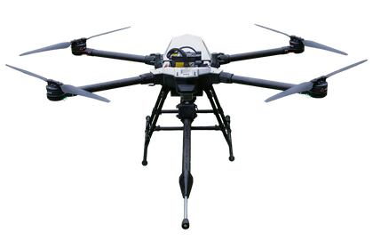
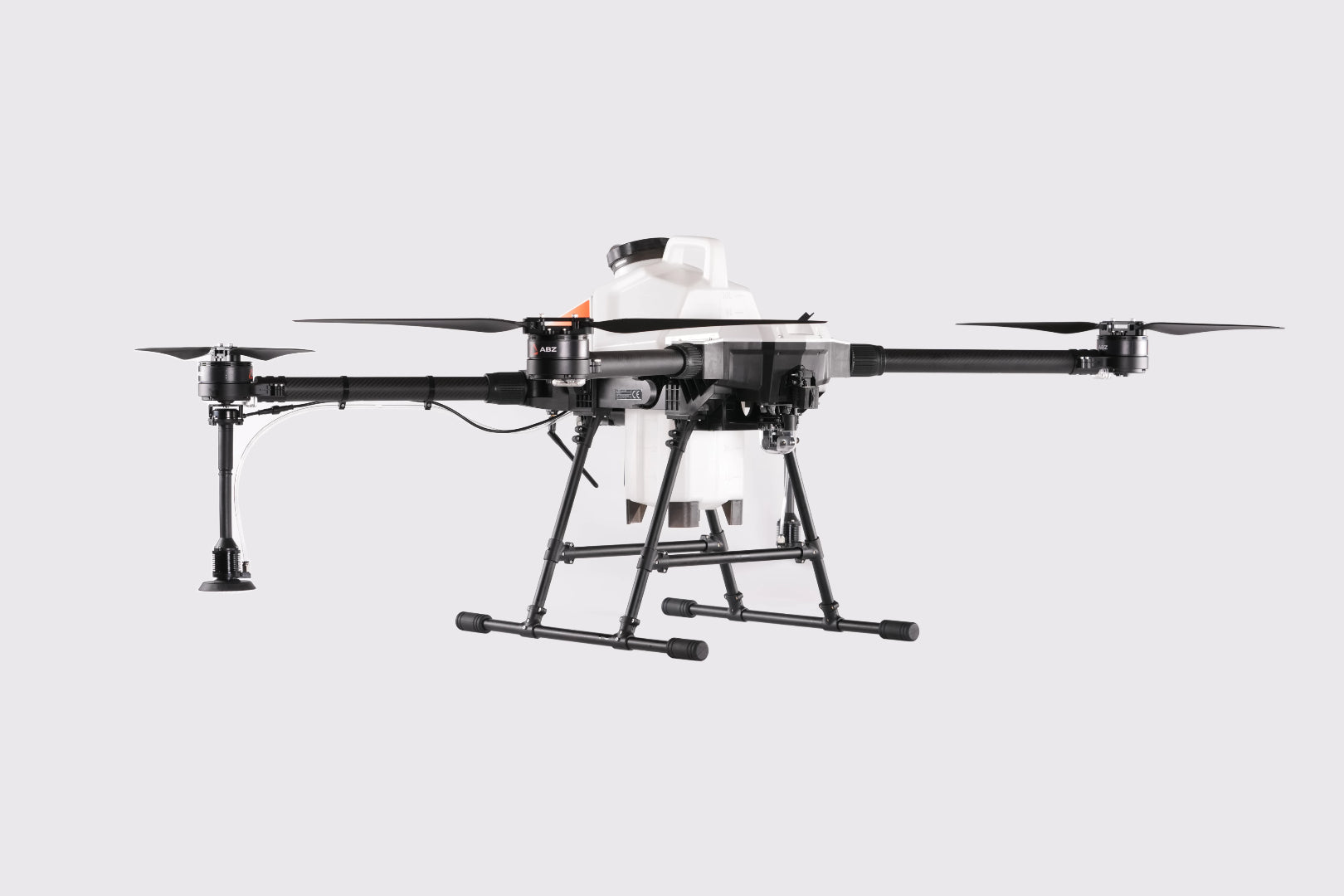
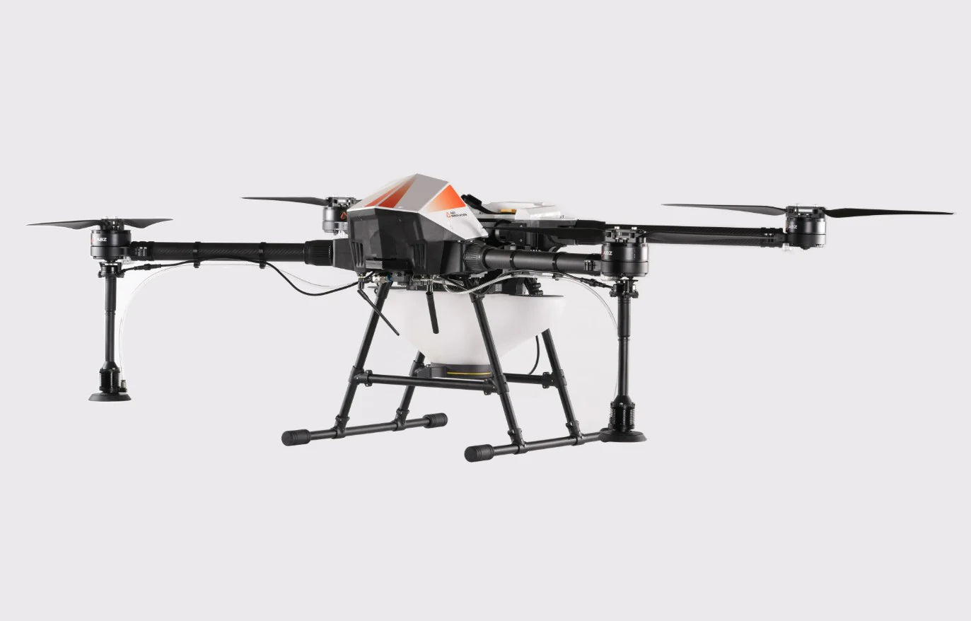

ABZ Innovation L10 V2 Drone (drone only)
- Order within
Key Features
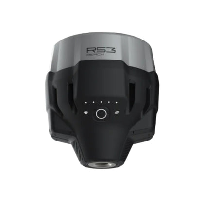
Advanced LiDAR Terrain-Following System
-
Utilizes a high-precision LiDAR sensor to continuously scan and map terrain in real time.
-
Enables automatic altitude adjustment over hills, slopes, and uneven ground for optimal spraying consistency.
Superior Obstacle Detection & Collision Avoidance
-
Detects thin power lines, poles, and moving objects within an 80-meter range.
-
Automatically halts or reroutes the drone to prevent collisions, ensuring operational safety.
Real-Time 3D Mapping
-
Generates a detailed point cloud and 3D map of the surroundings.
-
Allows for precise flight control and improved efficiency in complex environments.
Plug & Play RTK Integration
-
Fully compatible with EMLID RTK base stations via LoRa antenna, providing centimeter-level positioning accuracy for precision agriculture and surveying applications.
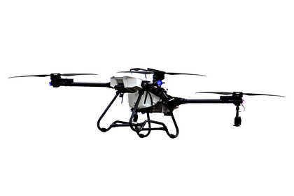
Modular & Convertible Design
-
Supports quick conversion to Trichogramma spreading or other agricultural systems.
-
Plug-and-play architecture ensures flexibility across various missions and payloads.
Proven Performance Lineage
-
Builds on the success of previous ABZ Innovation drone models, integrating field-tested reliability with next-generation sensing capabilities.
Why Choose This Kit?
The ABZ Innovation L10 V2 redefines what’s possible in agricultural and industrial drone operations. Equipped with a next-generation LiDAR sensing system, it offers unmatched altitude precision, obstacle detection, and environmental awareness. Unlike conventional drones that rely on a single beam, the L10 V2 scans in all directions—detecting thin wires, adjusting altitude automatically, and avoiding collisions effortlessly. Combined with RTK-level accuracy, a modular payload system, and ABZ’s proven engineering, this drone delivers superior performance, safety, and efficiency in every flight.
Ideal For
-
Precision agriculture requiring consistent spraying over variable terrain
-
Power line and infrastructure inspection in complex or obstacle-rich environments
-
Forestry and environmental mapping with real-time terrain adaptation
-
Research and R&D institutions developing advanced autonomous flight applications
Key Features
Advanced LiDAR Terrain-Following System
-
Utilizes a high-precision LiDAR sensor to continuously scan and map terrain in real time.
-
Enables automatic altitude adjustment over hills, slopes, and uneven ground for optimal spraying consistency.
Superior Obstacle Detection & Collision Avoidance
-
Detects thin power lines, poles, and moving objects within an 80-meter range.
-
Automatically halts or reroutes the drone to prevent collisions, ensuring operational safety.
Real-Time 3D Mapping
-
Generates a detailed point cloud and 3D map of the surroundings.
-
Allows for precise flight control and improved efficiency in complex environments.
Plug & Play RTK Integration
-
Fully compatible with EMLID RTK base stations via LoRa antenna, providing centimeter-level positioning accuracy for precision agriculture and surveying applications.
Modular & Convertible Design
-
Supports quick conversion to Trichogramma spreading or other agricultural systems.
-
Plug-and-play architecture ensures flexibility across various missions and payloads.
Proven Performance Lineage
-
Builds on the success of previous ABZ Innovation drone models, integrating field-tested reliability with next-generation sensing capabilities.
Why Choose This Kit?
The ABZ Innovation L10 V2 redefines what’s possible in agricultural and industrial drone operations. Equipped with a next-generation LiDAR sensing system, it offers unmatched altitude precision, obstacle detection, and environmental awareness. Unlike conventional drones that rely on a single beam, the L10 V2 scans in all directions—detecting thin wires, adjusting altitude automatically, and avoiding collisions effortlessly. Combined with RTK-level accuracy, a modular payload system, and ABZ’s proven engineering, this drone delivers superior performance, safety, and efficiency in every flight.
Ideal For
-
Precision agriculture requiring consistent spraying over variable terrain
-
Power line and infrastructure inspection in complex or obstacle-rich environments
-
Forestry and environmental mapping with real-time terrain adaptation
-
Research and R&D institutions developing advanced autonomous flight applications
1 x L10 V2 Drone