


AeroVironment Quantix Mapper Drone
- Order within
Quantix is a powerfully simple to use UAV empowering users through its fully-automated operation and instant insight. Its hybrid design allows the aircraft to launch vertically and transition to horizontal flight; maximizing aerodynamic efficiency and range. Users can immediately view high resolution imagery on the included Operating Tablet – no other devices, internet or additional software required. With the touch of a button, users can quickly and safely generate up to date maps for in-field assessment. Whether assessing crop growth during key stages, or damage from storm, flood and fire, Quantix Mapper makes It easy to gather accurate images across a large area, assess and react to situation with precision and speed.
View Your Fields From a New Perspective
- Easily survey your whole field from 360 feet up, when you want, in less time
- RGB color images at 1"/pixel resolution and multispectral images down to 2"/pixel resolution
- Easiest platform for capturing quality aerial imagery
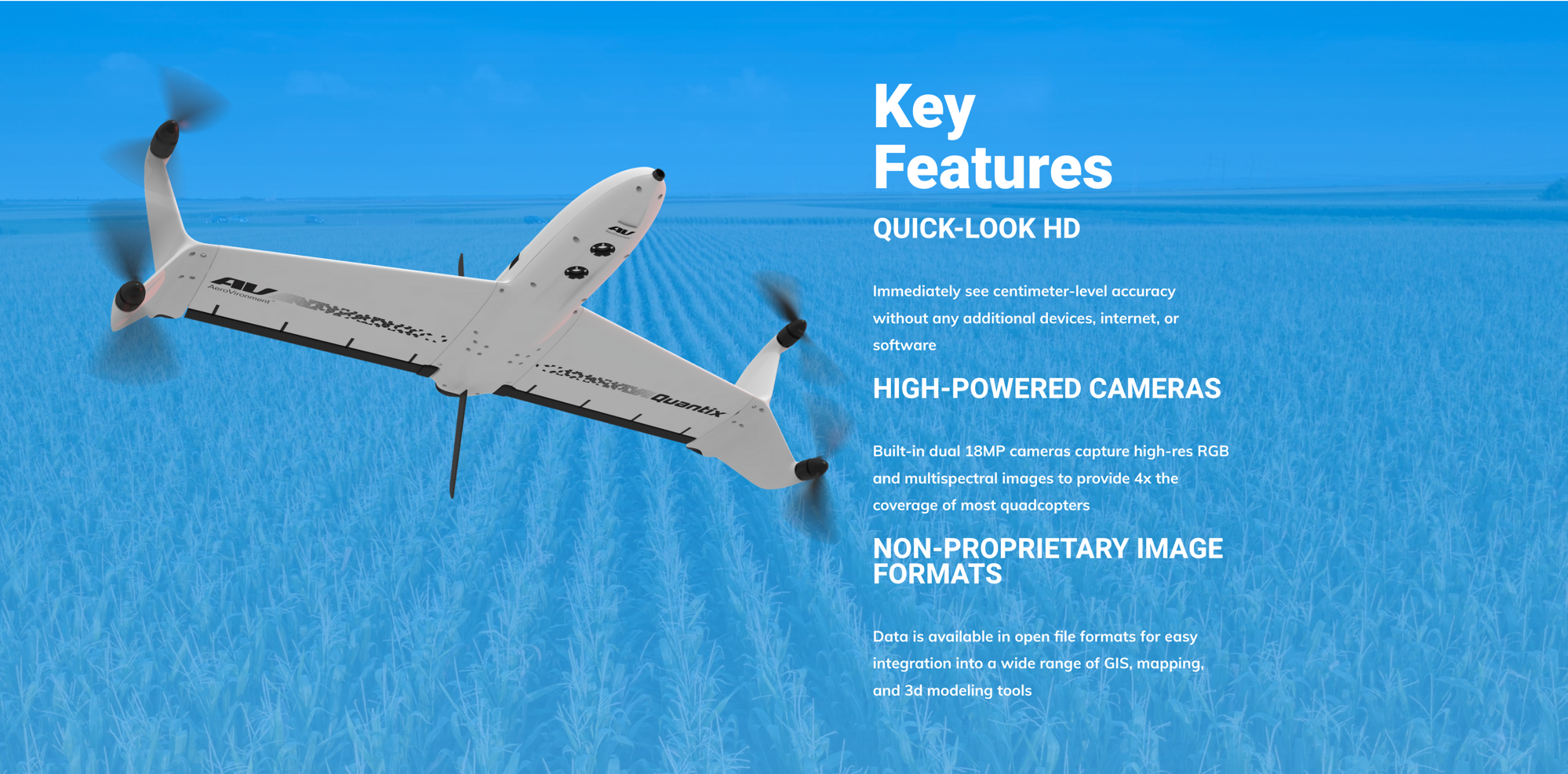
Effortlessly Fly and View Crop Health
- Fully automated flight operation. Simply define field area to be covered—Quantix™ does the rest
- Scout up to 400 acres in 45 minutes
- Dual built-in 18 megapixel cameras—No need to swap or fine-tune cameras
- RGB & NDVI Images are instantly available for in-field assessment. Answers you need are now available at your fingertips
Built to Last
Quantix™ was developed for on-farm reliability and features a durable, lightweight airframe with a one-meter wingspan and carbon fiber spar reinforcement. Vertical takeoff and landing provides for the safest flight operations, while protecting valuable on-board cameras.
Easy to Use. Easy to Understand.
Quantix™ integrates with AV DSS using advanced GIS technology and research-based analytics to process high resolution maps and images of your fields.
Powerfully Simple - Say Goodbye to the Learning Curve
With the simple touch of a button, Quantix™ initiates a fully-automated takeoff, flight and landing, eliminating the learning curve so even first-time flyers can successfully operate the drone.
Quantix™ quickly and accurately maps your acreage, allowing you to easily spot crop health and operational issues that might be missed by the naked eye. While still in the field using Quick-Look™ maps, anomalies can be identified and ground truthed to determine water, insect, weed and disease pressures, so you can catch potential issues before they start impacting yield.
Scout Faster and Farther with Ease
Innovative Efficient Design
- Takes-off and lands like a multirotor
- Range, reliability, and efficiency of a fixed-wing aircraft—up to 400 acres per 45 minute flight
- Allows for a safe launch and soft landing, protecting sensors
Collects Everything in One Pass
- Built-in dual 18MP Cameras
- Simultaneously collects high-resolution RGB & Multispectral
- Incorporates a self-calibrating solar sensor
Common Use Cases
- Infield Assessment
- Crop Scouting And Health Analysis
- Crop Growth During Key Stages
- Storm, Flood, Or Fire Damage Assessment
- Environmental Monitoring
- Flood Mapping And Elevation Modeling
Quantix is a powerfully simple to use UAV empowering users through its fully-automated operation and instant insight. Its hybrid design allows the aircraft to launch vertically and transition to horizontal flight; maximizing aerodynamic efficiency and range. Users can immediately view high resolution imagery on the included Operating Tablet – no other devices, internet or additional software required. With the touch of a button, users can quickly and safely generate up to date maps for in-field assessment. Whether assessing crop growth during key stages, or damage from storm, flood and fire, Quantix Mapper makes It easy to gather accurate images across a large area, assess and react to situation with precision and speed.
View Your Fields From a New Perspective
- Easily survey your whole field from 360 feet up, when you want, in less time
- RGB color images at 1"/pixel resolution and multispectral images down to 2"/pixel resolution
- Easiest platform for capturing quality aerial imagery
Effortlessly Fly and View Crop Health
- Fully automated flight operation. Simply define field area to be covered—Quantix™ does the rest
- Scout up to 400 acres in 45 minutes
- Dual built-in 18 megapixel cameras—No need to swap or fine-tune cameras
- RGB & NDVI Images are instantly available for in-field assessment. Answers you need are now available at your fingertips
Built to Last
Quantix™ was developed for on-farm reliability and features a durable, lightweight airframe with a one-meter wingspan and carbon fiber spar reinforcement. Vertical takeoff and landing provides for the safest flight operations, while protecting valuable on-board cameras.
Easy to Use. Easy to Understand.
Quantix™ integrates with AV DSS using advanced GIS technology and research-based analytics to process high resolution maps and images of your fields.
Powerfully Simple - Say Goodbye to the Learning Curve
With the simple touch of a button, Quantix™ initiates a fully-automated takeoff, flight and landing, eliminating the learning curve so even first-time flyers can successfully operate the drone.
Quantix™ quickly and accurately maps your acreage, allowing you to easily spot crop health and operational issues that might be missed by the naked eye. While still in the field using Quick-Look™ maps, anomalies can be identified and ground truthed to determine water, insect, weed and disease pressures, so you can catch potential issues before they start impacting yield.
Scout Faster and Farther with Ease
Innovative Efficient Design
- Takes-off and lands like a multirotor
- Range, reliability, and efficiency of a fixed-wing aircraft—up to 400 acres per 45 minute flight
- Allows for a safe launch and soft landing, protecting sensors
Collects Everything in One Pass
- Built-in dual 18MP Cameras
- Simultaneously collects high-resolution RGB & Multispectral
- Incorporates a self-calibrating solar sensor
Common Use Cases
- Infield Assessment
- Crop Scouting And Health Analysis
- Crop Growth During Key Stages
- Storm, Flood, Or Fire Damage Assessment
- Environmental Monitoring
- Flood Mapping And Elevation Modeling
Quantix Mapper Full Package